

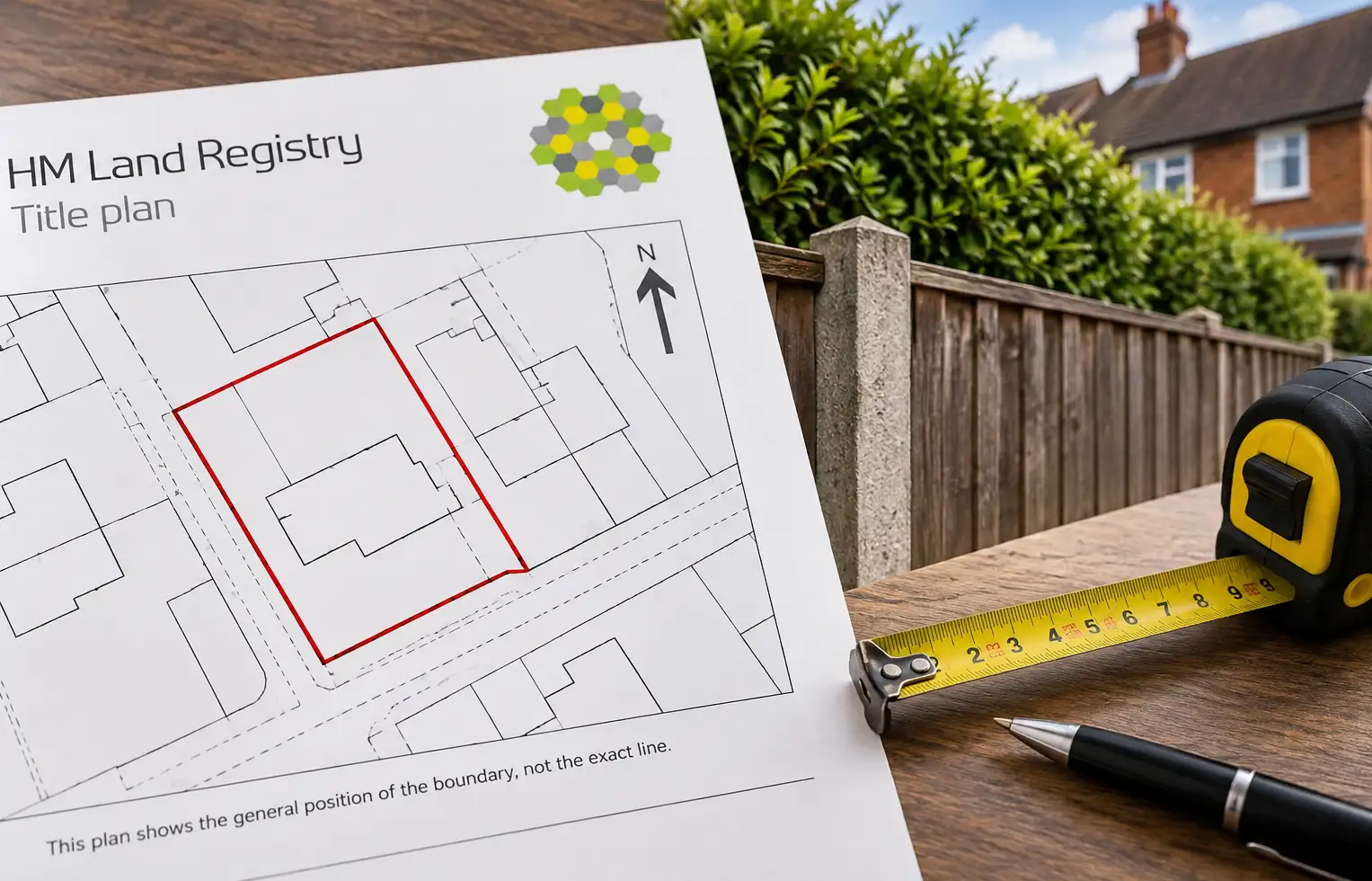
Take a ruler to a Land Registry title plan, measure from the red line to the fence, and you have not found your boundary. You have found a number that looks precise and almost certainly isn’t.
HM Land Registry is explicit about this. The red edging on a title plan shows the general extent of the registered land; it does not identify the exact position of the legal boundary, and measurements scaled from the plan should not be relied on to locate that boundary on the ground. HM Land Registry’s guide to reading a title plan makes that warning clear.
This article covers England and Wales, where HM Land Registry operates. Scotland’s land register is run separately by Registers of Scotland, and Northern Ireland’s by Land & Property Services, under different legislation and registration systems.
This matters more than it sounds like it should, because so much can ride on the assumption that the red line is exact: where you intend to build, whether a replacement fence is going back in the same place, what a buyer’s solicitor may query and whether a disagreement with a neighbour needs professional intervention.
Understanding why the plan cannot do that job on its own is the first real step towards understanding where a boundary actually sits.
Two different boundaries, doing two different jobs
HM Land Registry distinguishes between a legal boundary and a physical boundary.
A legal boundary is an invisible, exact line separating one person’s land from another’s. It has no width or thickness and is rarely identified with precision either on the ground or in conveyances or transfers.
A physical boundary is something you can actually see: a fence, wall, hedge, ditch or another feature. The legal boundary may run through it, along one side of it or somewhere else. A hedge can spread, a fence can be replaced in a slightly different position and a wall may never have been built exactly on the legal line in the first place.
That is why an old fence or wall can be useful evidence without automatically being the answer.
The great majority of registered titles in England and Wales are governed by the general boundaries rule in section 60 of the Land Registration Act 2002. Unless a boundary has been formally determined, the title plan shows its general position rather than fixing its exact line.
There is also no standard tolerance that can be applied to the red edging. HM Land Registry’s current boundaries guidance specifically says there is no standard measurement, ratio or tolerance between the general boundary shown on a title plan and the legal boundary on the ground.
So there is no reliable rule such as “allow half a metre either side of the red line”. The uncertainty cannot be converted into a universal numerical allowance.
What the deeds can tell you
When the exact position of a boundary genuinely matters, the documentary evidence becomes important.
In the House of Lords case Alan Wibberley Building Ltd v Insley [1999] UKHL 15, Lord Hoffmann described the first resort in a boundary dispute as looking at the deeds. The judgment also explains why plans used merely for identification, small scales and thick boundary lines may be inadequate to establish a precise line.
But “look at the deeds” does not mean that one old plan automatically settles the matter.
HM Land Registry’s current guidance says the position of the legal boundary depends on the relevant pre-registration conveyance or transfer as a whole, including its plan. If that material is not sufficiently clear, physical features and other evidence from the time may help establish what land was actually intended to be conveyed.
That qualification matters because deed plans are often marked “for identification purposes only”. That wording is a strong warning against treating a plan as though it were a modern measured survey, but the legal question is still what the relevant conveyance or transfer, read as a whole, actually conveyed.
In many cases the most useful document is the conveyance or transfer that created the boundary by separating land that had previously been in one ownership. Later deeds may simply repeat an earlier description. Historic Ordnance Survey mapping can also help establish what physical features existed, but an Ordnance Survey line does not itself determine a private legal boundary.
It is a process of building a picture from several pieces of evidence, not consulting one definitive map.
A fence does not automatically tell you who owns it
Boundary position and boundary-feature ownership are related questions, but they are not the same question.
There is no general legal rule that the side showing the fence posts belongs to the owner of the fence. HM Land Registry expressly warns that common beliefs based on the way a fence or wall is constructed have no legal foundation.
The title register or filed deeds may contain useful information about ownership or responsibility for maintenance. “T” marks can be relevant where they are properly referred to in the deed and reflected in the register, but a T mark appearing on a deed plan without supporting wording does not automatically carry special legal force.
So if the real question is “whose fence is it?“, the red line on the title plan is not enough to answer that either.
Getting more precision, if you actually need it
For most properties, registration with general boundaries is perfectly adequate. Where greater certainty genuinely matters, HM Land Registry recognises two main routes: a boundary agreement and a determined boundary.
A boundary agreement
A boundary agreement allows neighbouring owners to agree where an uncertain legal boundary lies.
Its legal effect is stronger than simply recording two people’s opinion. HM Land Registry’s current guidance on boundary agreements explains that there is a rebuttable presumption that such an agreement identifies the true boundary rather than transferring land, and that an agreement demarcating an unclear boundary can bind the parties and their successors.
However, recording a boundary agreement against the titles does not turn that boundary into a formally determined boundary. Unless it is determined under section 60, the boundary shown for registration purposes remains a general boundary, and HM Land Registry does not guarantee that the legal boundary is where the agreement says it is.
There is another important distinction. If the neighbours are actually moving the boundary and transferring land from one title to the other, that is not simply a matter of recording where an uncertain existing boundary lies. A proper transfer and registration may be required.
A determined boundary
A determined boundary goes further. It records the exact line of the legal boundary for the purposes of the register.
The line must first be identified from the available evidence and shown on a sufficiently precise plan. The registrar must be satisfied that the application identifies the exact line claimed, that there is an arguable case for that line and that the relevant adjoining owners can be identified and notified.
HM Land Registry recommends using a chartered land surveyor or another suitably qualified professional to prepare the plan, and its determined-boundary plan requirements are far more exacting than those for an ordinary title plan. Form DB is available for applications to have a boundary shown in the register as determined.
There is a crucial limitation: HM Land Registry does not decide a boundary dispute simply because one neighbour asks it to determine the line.
If an adjoining owner objects and the objection is not groundless, the parties must either reach agreement or the matter is referred to the Land Registration division of the Property Chamber, First-tier Tribunal.
Even after a boundary is determined, the ordinary title plan does not become a centimetre-accurate survey drawing. HM Land Registry marks the general position of the determined section on the title plan and retains the detailed determined-boundary plan from which the exact line can be identified.
What this means in practice
If you are trying to establish where your boundary actually is, start with the documents and the physical evidence rather than measurements from the red line.
Read the title register and title plan together. Check whether the register refers to a transfer, conveyance, boundary agreement or another document and whether it says that a copy has been filed.
If HM Land Registry holds the relevant document, you can request a copy of the filed deed or transfer. Not every historic document is retained, so a deed being mentioned in the register does not necessarily mean that HM Land Registry still holds a copy.
Then compare the documents with the features on the ground. An established wall, fence, hedge, ditch or building line may be useful evidence, particularly if it can be shown to have existed when the relevant land was divided, but it should not be treated as conclusive on its own.
Do not scale a measurement from the ordinary title plan and treat the result as proof.
If you and your neighbour agree where an uncertain boundary lies, consider whether putting that agreement in writing and recording it is worthwhile. If exactness genuinely matters, a determined-boundary application may be more appropriate.
And if there is already a dispute, be cautious about moving a fence, demolishing a wall or carrying out irreversible work before the evidence has been properly assessed. Boundary disputes have a well-earned reputation for becoming disproportionately expensive compared with the value of the strip of land involved.
For most owners, none of this needs to become urgent. It becomes worth establishing the position properly when the exact line materially affects what you intend to do — for example, before moving an established boundary feature, carrying out work close to a disputed line, buying or selling land whose extent is unclear, or acting on an assumption that a particular strip belongs to you.
Scotland and Northern Ireland work differently
The general boundaries rule in section 60 of the Land Registration Act 2002 is an England and Wales rule. It should not be applied as though it governs the whole UK.
In Scotland, Registers of Scotland maintains the Land Register and cadastral map under a separate Scottish system. Its property-boundaries guidance explains that the cadastral map shows the registered extent of a property, generally with a red line, while older Sasine deeds may contain boundary descriptions or plans of varying quality.
Northern Ireland has its own Land Registry system. Land & Property Services states in its guidance on the Land Registry map that the map indicates the location of registered holdings but does not guarantee their boundaries. Article 64 of the Land Registration Act (Northern Ireland) 1970 provides that, unless otherwise stated, the map description is not conclusive as to the boundaries or extent of the land; there is a separate procedure through which boundaries can be made conclusive.
So if the property is in Scotland or Northern Ireland, use the relevant registration system and legal guidance rather than treating an England and Wales title-plan rule as UK-wide.
Important: This article provides general property information, not legal, financial, surveying or other professional advice for your individual circumstances. Boundary disputes can depend on historic documents, physical evidence, the history of adjoining land and the applicable law. If significant money, property or legal rights are at risk, or you are considering moving a boundary feature or taking legal action, take appropriate professional advice before proceeding.